| My Experience | |
|---|---|
| Number of Visits | 1 |
| Length of Stay | 5 Days |
| My Favorite Spots | Pullouts on Main Park Road Clingman’s Dome Mingus Mill Spruce Flat Falls Wonderland Hotel |
| Expenditures | Hotel: Not Recorded Flight: Not Recorded Rental Car: Not Recorded Food: Not Recorded |
| Miles Hiked | ~15 |
| # of Photos Taken | Not Recorded |
The Trip Overall
Great Smoky Mountains is the most heavily visited national park in the system with more than 1 million visitors per month in the busy season. My experience definitely confirmed that. I visited during the early weeks of the Fall color season and it was packed with people and cars. The crowds were off-putting enough for me to conclude that the Smokies is the most overrated of the national parks.
That said, I had a good time. I managed to catch a couple of the photos I was very interested in (mostly Fall color combined with streams or waterfalls) and I got to hang out with my long-time friend Chris, who has joined me on several other park trips. We stayed 5 days, three in Gatlinburg and two days in the Cade’s Cove area.
The Smokies are an easy 8-hour drive from DC, so I am sure I’ll go back, but I’ll try another season next time.
The Map
I am not a Smoky Mountain expert, but my research of the park broke it into a few main sections. My focus was the Roaring Fork Motor Trail and the trails around there, the main park road between Gatlinburg and Clingman’s Dome, and Cade’s Cove. Of course there are dozens of trails, waterfalls, and vistas. I just scratched the surface.
[googlemaps https://www.google.com/maps/d/embed?mid=zqY-hEQcTB9Y.kO_l5C9joz1A&w=1200&h=600]
Click on the camera icons to see a photo, a location name, and coordinates for the closest parking area. I also show park entrances, visitor centers, the hotel(s) where I stayed, hiking trails, and airports.
Visitor Statistics
The Smoky Mountains are busy; very busy. I visited in early October at the very beginning of the Fall color season and it was overflowing. I can’t speak for the rest of the year or the less touristy areas of the park, but the overwhelming number of people in Gatlinburg and Cade’s Cove did not instill me with confidence. There were miles long traffic jams going into and coming out of the park at Gatlinburg and too many people for my taste.
This graph shows the average number of visitors each month. Hover over the line to see values for each month. NOTE: Even though the X-axis reads “2000,” these are monthly averages from the most recent 5-year period. The “2000” should be ignored.
The Climate
The weather was OK while we were there. I don’t remember the exact temperature, but there were chilly mornings and pleasant days. There were a few rainy periods that washed out our photography prospects, but plenty of breaks too.
This graph shows average temperature and precipitation by month. Hover over the line to see values for each month. You can select different variables and parks in the panel on the left. NOTE: Even though the X-axis reads “2000,” these are monthly averages of NOAA weather data dating as far back as the early 1900’s. The “2000” should be ignored.
Logistics
| NPS Survey Findings(1) | |
|---|---|
| % Visiting for First Time | Not Reported |
| % Staying More than 24 Hours | 43% |
| Average Length of Stay | 1.9 Days |
| Top 5 Attractions | Cades Cove (57%) Sugarland VC (42%) Newfound Gap (35%) Clingman’s Dome (22%) Oconaluftee VC (31%) |
| Average Expenditures | Not Reported |
| (1) Visitor Survey Project Report Great Smoky Mountains National Park 2008 | |
Lodging
We stayed three nights in Gatlinburg at the Days Inn. It was OK at best. What it did have going for it was the fact that it was on the edge of town…only a few blocks from the park boundary so we didn’t have to drive through the mess that is Gatlinburg to get into the park. We also stayed at the Townsend Gateway Inn in Townsend, TN for two days while we explored Cade’s Cove. I cannot say enough great things about this place. The staff was great, the room was wonderful, and it was only about a 30 minute drive to Cade’s Cove. I highly recommend it.
Food
Chris and I stopped for groceries in Pigeon Forge before heading to Gatlinburg. We were both trying to conserve money so groceries made up the majority of our diet on the trip. We ate at the Burger Master Drive-In and Black Bear Cafe in Townsend. Both were good.
My Experience
I live in the Washington, DC area which is a reasonable 8-hour drive from the Great Smoky Mountains. It took me 5 years to make my first trip, and the trip was very easy. This is one of the longest national park trips I’ve taken. I knew there was a lot to see and I wanted to spend significant time in a couple small areas. I didn’t have a lot of freedom to plan the trip, so I ended up in the park a bit early for prime leaf season. The leaves had started to turn at the higher elevations, but not at the lower elevations. If you haven’t picked up on it already, I did not enjoy myself. I hate being a whiner, but it was just a poor experience. Let me tell you why.
Day 1
I woke up early one morning and made a quick drive down I-81 to Knoxville where I picked up Chris at the airport. We drove the hour to Gatlinburg, stopping for groceries along the way. We made it just before dark, checked into the hotel and started to explore the town. Gatlinburg is the very definition of a tourist trap. There were moonshine tastings going on all over the place. We counted seven old timey photo places. There were people everywhere. We enjoyed ourselves listening to a bluegrass band and sampling some of the moonshine, then prepared ourselves for the next day.
Day 2
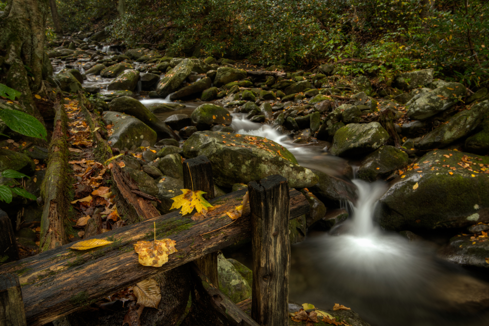
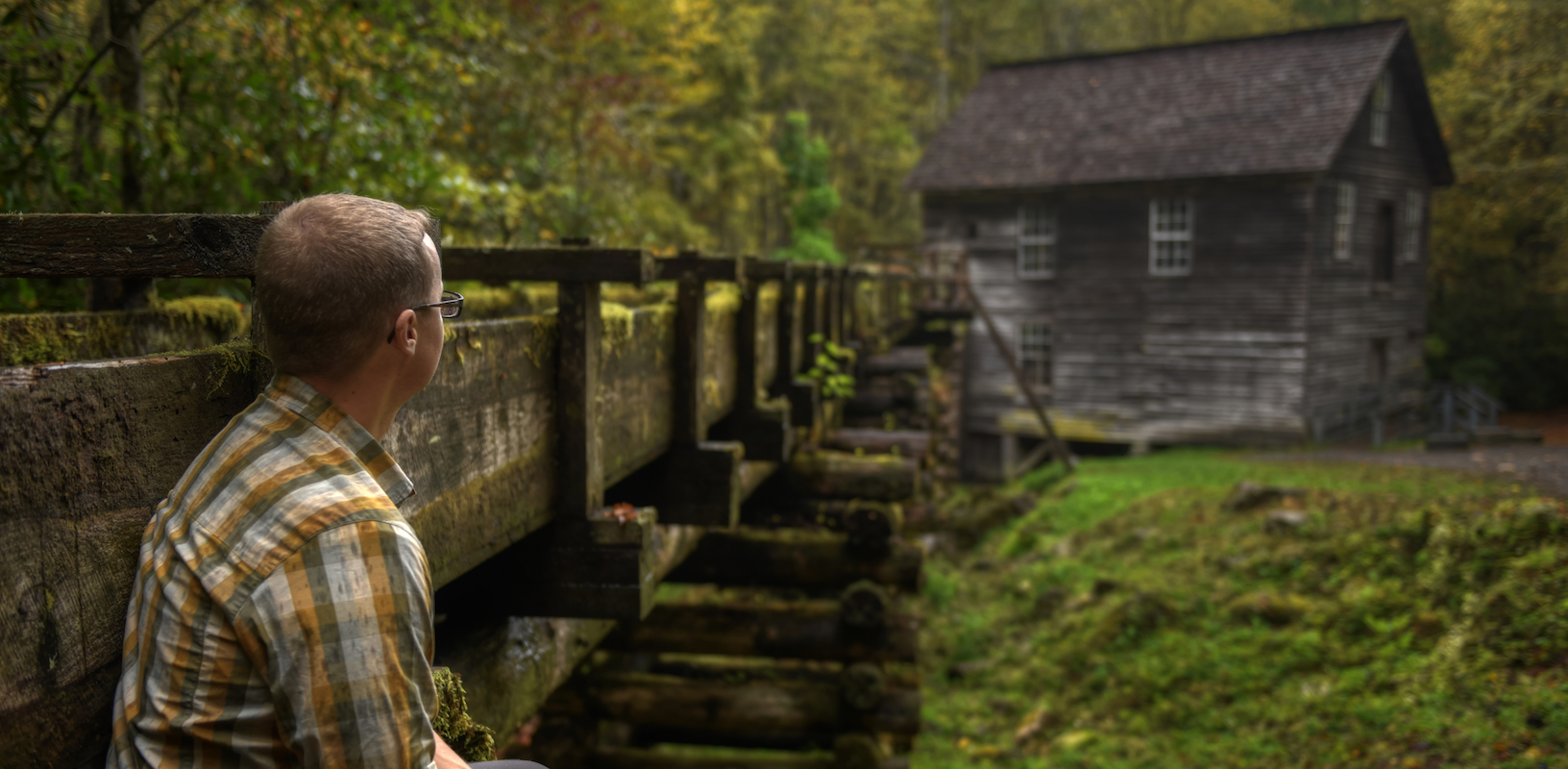
For our first day in the park, all I had planned was the Roaring Fork Motor Nature Trail. We hit the road well before dawn and made our first stop at Ogle Place in the dark. We hung out in the car until it started to lighten up and then explored a bit. The cabin itself wasn’t that interesting, but the mill about a quarter mile away was very picturesque for a first photo spot of the trip. We spent over an hour there. There was off-and-on rain and we occasionally had to pack our stuff up and head into the mill.
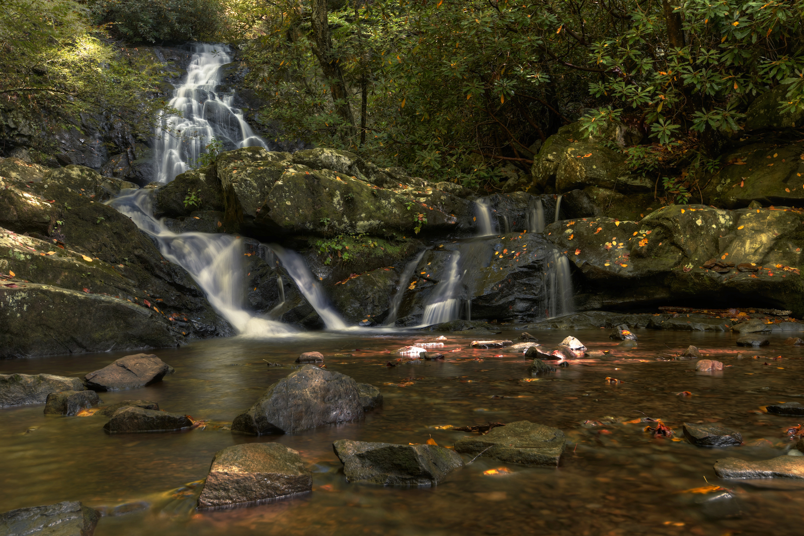
By the time we headed back to the cabin people had started to gather. We spent another 20 minutes or so photographing the cabins before moving on. My interest on the trip was seeing waterfalls and cascades and the overcast skies were perfect for photographing those. Our next stop was Grotto Falls. By the time we made it to the trailhead, it was completely packed with cars. We found a spot that may or may not have been an actual parking spot a few hundred feet down the road. The hike up was reasonable and Chris moves fast enough that I was struggling to keep up, but we passed several groups of people with children so I was happy to be in front of them. When we made it to the falls we were, miraculously, alone. Chris and I still managed to get in each other’s way trying to snap our pictures. We had about 10 minutes before those people that we passed started to show up. By then we had moved back looking for wider shots. In retrospect, we probably should have started with the wider shots and then moved in.
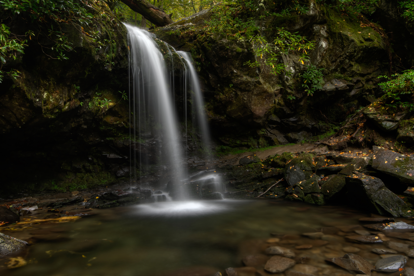
The problem with Grotto Falls is the trail behind the falls…the grotto. Everybody has to get their picture standing behind the falls and people never seem to know how to work other people’s cameras. I picked out a couple angles of the falls that I wanted to get and I waited for a clear shot. And I waited, and I waited. I eventually got some that were close enough and was ready to go.
We quickly walked back to the car and moved on to Homer Bales’ Cabin. By that time, I was burned out on cabins and was more interested in the cascades that ran next to the property. So I hopped from rock to rock and found some shots.
We closed out the Roaring Fork Motor Trail around eleven o’clock with a stop at Ely’s Mill. Driving by we saw some old barns and decrepit vehicles and had to stop.
By then it was time to eat so we headed to the Bush’s Baked Beans Factory in Dandridge, TN. It is a 40-minute drive from Gatlinburg, but it was the kind of kitcsch that Chris lives for. We took the tour, watched a surprisingly interesting video, and ate at the restaurant…and yes, I had beans. After a quick trip through the gift shop, it was time to head back to the hotel for a mid-afternoon nap.
By the time we started moving again, we realized that the sky wasn’t going to clear up and decided to skip trying to photograph the sunset. We settled for trying to find more old time photo places instead.
Day 3
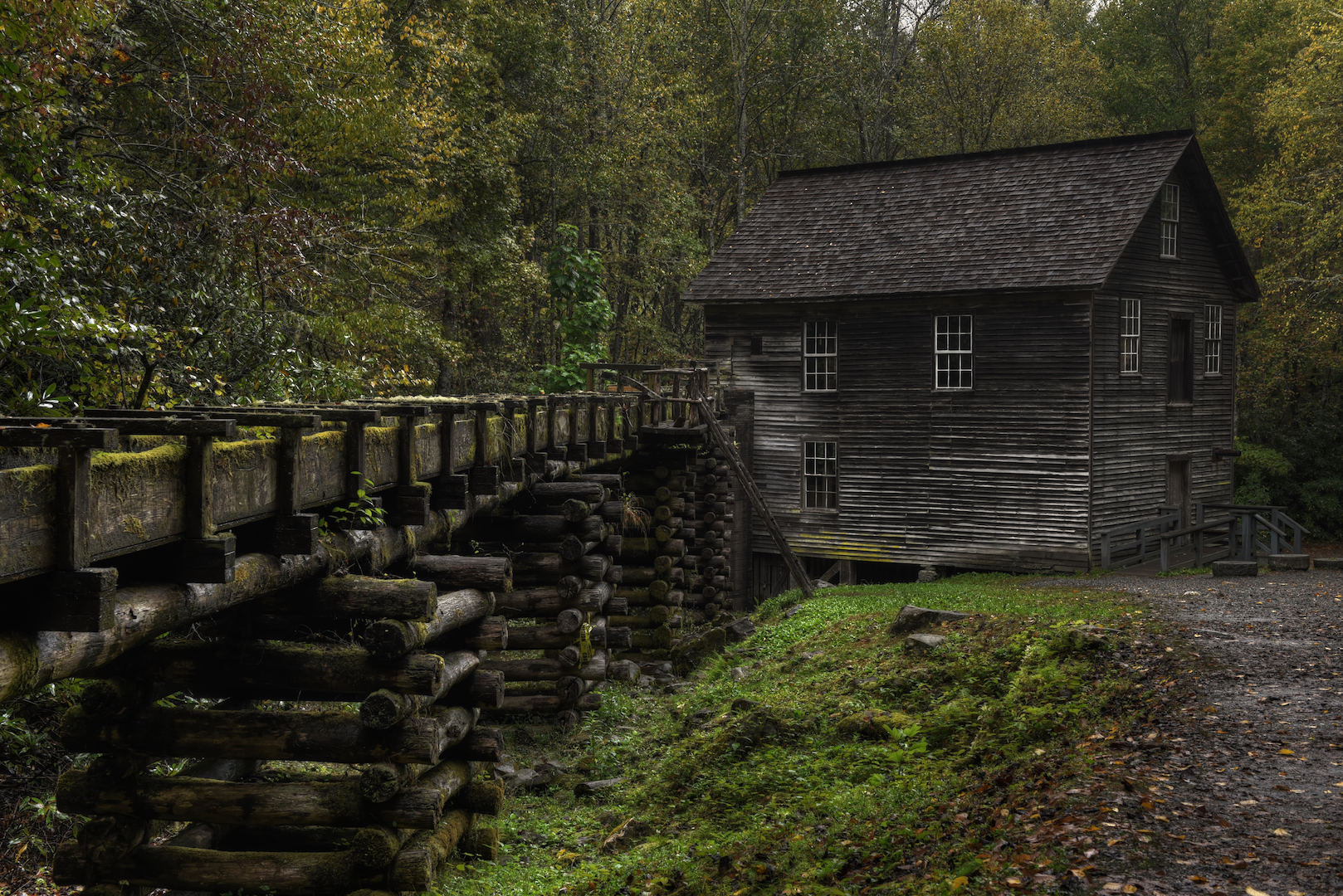
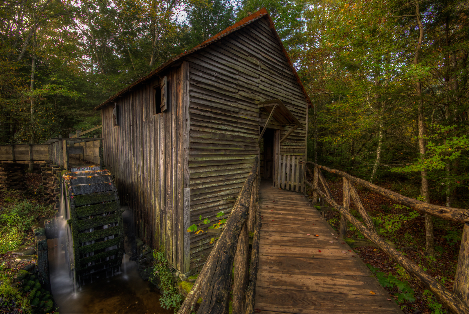
The next morning we woke up with the intention of catching sunrise at Clingman’s Dome. We weren’t optimistic as it was drizzling when we got into the car, but were hopeful that we would get above the clouds by the time we hit the summit. We never did. As we got to the point where you can turn off to head to the Dome, it was raining and extremely foggy. It didn’t look like it was going to pan out. So we kept on driving, right down the other side of the mountains into North Carolina to the Mingus Mill. We’d driven over an hour at that point and we still arrived before sunrise. It was damp, but at least it wasn’t raining there so we put on our headlamps and went out walking.
We spent about an hour and a half photographing the mill; trying various things. No one ever came during that time. I definitely got the impression that the east side of the park would have been more of the solitude I was looking for. Yet still, we hopped back into the car and drove back to Gatlinburg. By that time it was raining hard. There wasn’t much photography to be done so Chris and I played indoor miniature golf, got some coffee, and chatted about things.
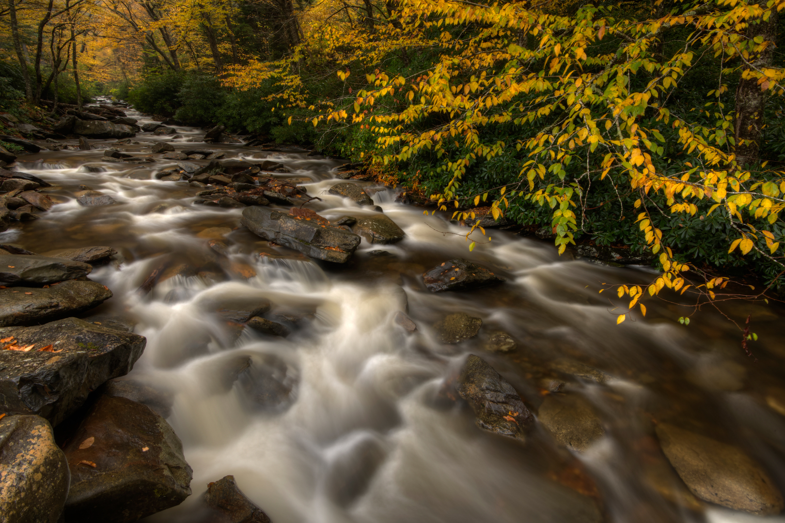
After about 8 hours of sitting inside, I decided I was going to head out to get some photos. It was still lightly raining, but I wanted to head back to some places I’d seen along the main park road. Chris was more interested in the baseball playoffs, so we parted ways. I drove up to Newfound Gap, the third time that I’d been there on the trip, and it was still socked in by clouds. I started driving back toward Gatlinburg where I found this long, straight tunnel of yellow trees hanging over the Walker Camp Prong. That is what I had come out for. I saw it earlier in the day and knew I needed to come back. It was one of the most picturesque areas along the road, but it wasn’t a built up spot. I had to parallel park in the tiny parking area between a couple large vans. There were maybe a couple dozen people there and I had to angle my camera to make sure they weren’t in my photos, but all of that turned out to be worth it. This was my favorite moment on the trip.
I made a few more stops as I headed back at the Alum Cave Trail and other little roadside waterfalls and streams. I didn’t linger very long. It was getting dark and there was no colorful sunset light to be had.
Day 4
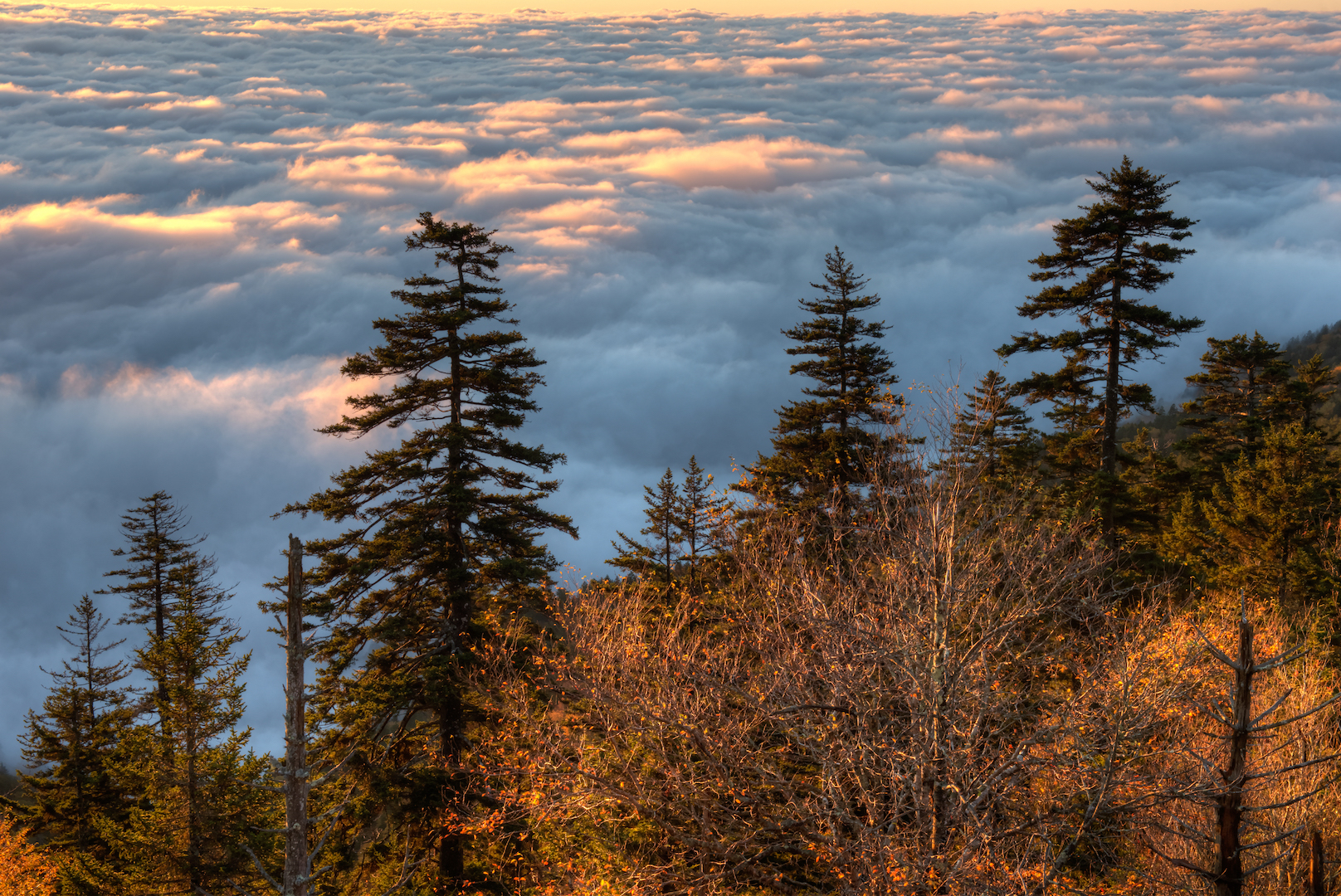
Day four started the same as day three had. We woke up early with the intention of heading to Clingman’s Dome for sunrise, walked outside and found it damp and drizzling. This time, however, we did find the top of the clouds on the drive. As we hit the turnoff from the main park road, it was clear that we were in for something special. Where there were breaks in the trees you could see clouds stretching out to the horizon…exactly what I was hoping for. The road seemed to go on forever, but eventually dead-ended into a parking lot filled with dozens of cars. There were already a lot of people there waiting to see exactly what we had come to see; a beautiful cloudtop sunrise.
I grabbed my gear and tried to find something that would work as a foreground. There really wasn’t anything. On top of that, the sun was coming up at a weird angle to make for an interesting shot. I was left to simply enjoy the sunrise (and occasionally snap a bunch of pictures). None of them turned out, but it didn’t really matter.
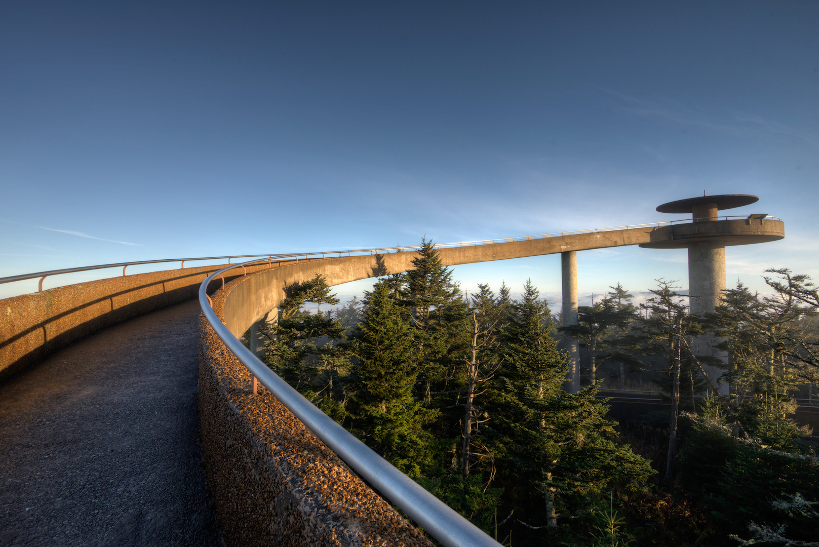
After the sun had come up, Chris and I walked up to the peak and the observation tower. It was a longer, steeper walk than I expected. I had always assumed that you parked near the observation tower when, in fact, it’s another half mile or so. At that time in the morning at that elevation it was cold and windy but that just meant fewer people made the trip. There were only a couple other people at the top during the 20 minutes we stayed. We were above the clouds with the sun so the lighting was pretty intense, but there were still beautiful views off to the west.
We walked back down to the lot and headed back toward Gatlinburg. We had packed our things and checked out of the hotel before heading out, so we had no reason to head back into town. Instead, we headed south on Fighting Creek Gap Road toward the Elkmont Region of the park. Chris gets sick of nature pretty quickly. He prefers unique, historic, odd stuff to waterfalls and scenic vistas. In researching the park, he had come across a video (that I can’t seem to find now) from a guy that toured an abandon hotel in the Elmont Region of the park so, of course, we had to go visit. There turned out to be much more to it than just a hotel.
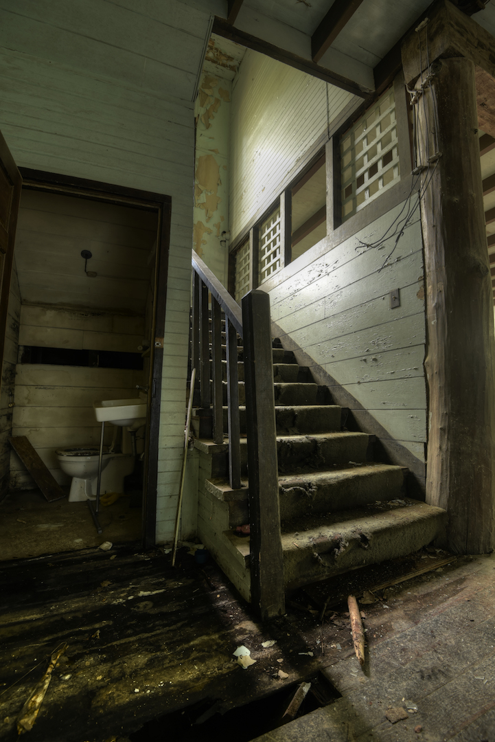
The hotel, itself, is called (was called) the Wonderland Hotel. It is in sorry shape these days, but was once apparently a nice looking establishment. It has a gritty, urbex, feel to it now. I will say that I do not advocate going into the place. We did, but not because we didn’t think it was dangerous, but because we cared more about getting pictures than our personal safety. It is dangerous. The flooring is quite soft in some places and parts of the building have caved in. If you go in and get injured, take some personal responsibility and don’t try suing the park.
Alright…moving on. We explored both floors of the hotel before wandering back out. There, we saw an outlying building. We went over to take a look and found an abandon house. We took some more photos of that and then discovered another house, and another house. There was a whole street (well, dirt road) of abandon houses. We went from one to another poking around and eventually bumped into a mother and daughter who were out exploring too. The older lady’s grandfather had owned one of the houses we had been photographing. The park had been formed before she was born so she never visited the house in it’s prime, but stopped by to see it occasionally. Her daughter also told us that this was where the famous synchronized fireflies of the park come out in the late spring.
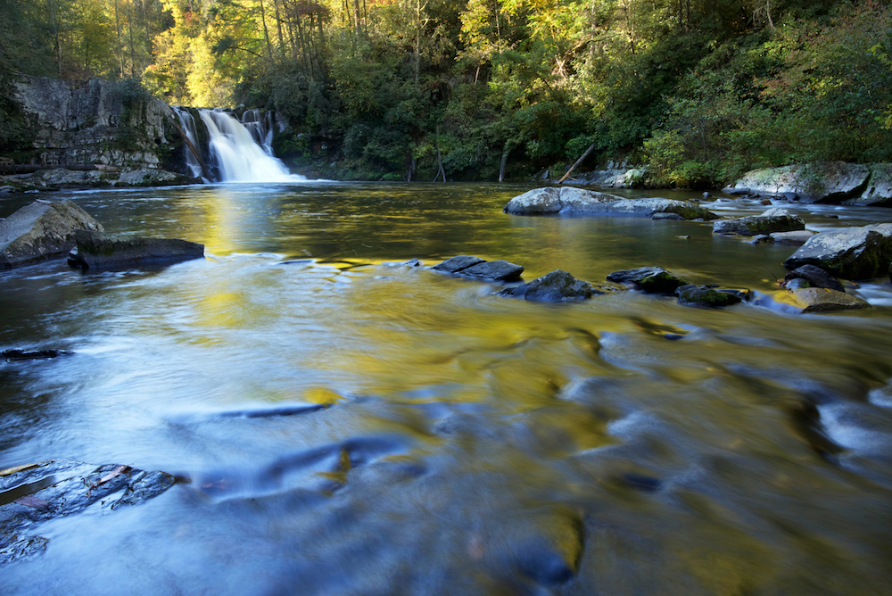
Now that Chris got his urbex shots, I wanted to see more waterfalls. We drove a few more miles south to the Great Smoky Mountains Institute. From there, it’s a medium difficulty hike to Spruce Flats Falls. I say medium because the last part of the journey drops quite a bit. Walking back up that is your first part of the journey back. It’s tough. Spruce Flats was my favorite waterfall on the trip. It is picturesque and the somewhat difficult hike and relatively remote location made it less densely packed than some of the others. We spent over an hour there trying out different photos before heading back to the car and into Townsend, TN where we checked into our hotel and got something to eat.
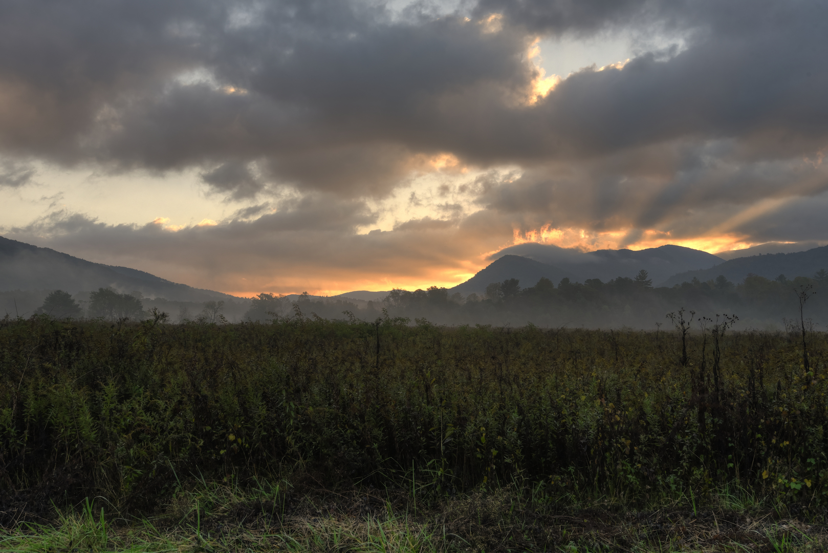
That night, for sunset, we headed into the overrated 12-mile long traffic jam that is Cades Cove. It is hard to overstate how disappointed I was with the experience of this area. You hear a lot about the open fields, wildlife, and cabins in this area, but you don’t hear much about the traffic, the people, and the hours of admission. Let me fill you in. The cove is surrounded by a single-lane, one-way road. There are a few two-way dirt roads that cross the area, but the main road you take to get around is a singular point of failure.
When Chris and I drove into the park a couple hours before sunset, we were filled with ideas about where we wanted to go and the areas where we thought we might find wildlife. Chris was adamant about photographing a bear. I was happy to have an open area where I might catch a sunset. What we found was the back of a line of cars. The speed limit in the cove varies between 15 and 25 mph, but people drive about 5 mph hoping to see wildlife. If they do see wildlife they stop and people 40 cars back are just stuck. Occasionally, we would come around a bend and see the full line of cars out ahead of us. It was soul destroying.
We decided we needed to just get out of the traffic jam. We pulled off near the back end of the cove at the trail that leads to Abrams Falls. It was too late to hike to the falls, but there was a closer cabin that we walked to; the Elijah Oliver Cabin. There was no one there. It was nice given what we’d just went through. We were hoping that the absence of people would help us find bears, but no luck.
We got back to the car 30 minutes after sunset and it was getting dark. The traffic had died down, but there were still plenty of cars on the road. We decided we would stop at the Cable Mill and scope out some places where we might photograph sunrise.
On the way out of the park, we got caught in more traffic. It was never clear what was causing the traffic. I assume someone saw a bear, but it was dark, so there weren’t any beautiful views to stop and look at. We figured we would outsmart these people and get here early the next day. No such luck.
Day 5
The next morning we drove the 30 minutes from our hotel to Cades Cove and arrived an hour before sunrise. As we approached the entrance, we found ourselves at the back of a line of 10 cars. The gates were closed! It closes at night and opens around sunrise. As we sat there, we didn’t know when it would open. We waited that hour, watching the twilight start to creep in and the line of cars behind us get longer and longer. By the time the gates were open there were about 40 cars waiting to get in (wildlife watchers).
Chris and I had a plan though. We were going straight to the Visitor’s Center and the mill we’d seen the night before. Many of the drivers ahead of us peeled off on the dirt roads that criss-cross the cove and eventually we had a wide-open road to our destination. As we pulled into the parking lot at the Visitor’s Center, we saw a couple male deer with their horns locked together. They weren’t bears, but that was the next best thing. We both tried to get our shots of them…neither of us had the right equipment for wildlife photos.
We had about 30 minutes to ourselves with the deer and the Cable Mill before other’s started to arrive. Next on my list was a hike to Abrams Falls (below right), so we moved on to that. It is a lengthy hike, about 3 miles each way so it took us the rest of the morning. The falls was OK, but not great. At that point, we were ready to get out of the cove and relax a bit. We headed back to Townsend, ate, and napped.
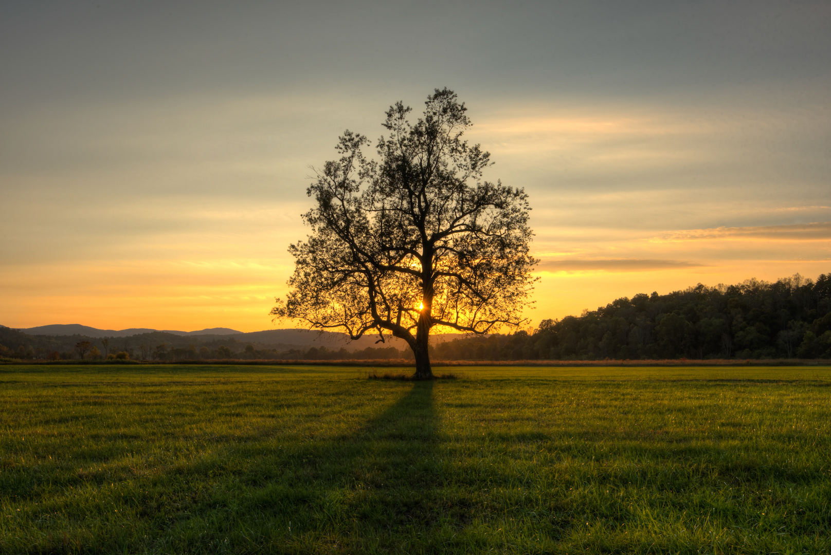
That evening we went back to Cades Cove, (above left) but with the plan of not going farther than the first cross-cutting dirt road. This trip was all about seeing bears. Spoiler alert: we didn’t see any. I finally got the sunset I was looking for though. From where we’d parked, I spotted row of trees and thought they would make a great foreground. I did my thing while Chris looked for wildlife. He did end up getting some more pictures of male deer battling it out, but no bears.
Day 6
For our last morning in the park, we decided that the spot we’d been for sunset was the right spot, but maybe not the right time. We ended up back in line waiting to get into the park and headed straight to the spot once we got in. Chris went for his deer and I wandered down the dirt road looking for a vantage point for sunrise. There was a spectacular sunrise that morning, but I wasn’t in the best position to capture it. I got some photos of the dirt that I liked and was ready to call it a day. Chris found some more deer, but still no bears.
And that was that. We headed back to the hotel, had breakfast, and I took Chris to the airport. On my way back to DC, I headed back through the park, stopping at some of the overlooks as I crossed the border into North Carolina. I finished out the day by driving the Blue Ridge Parkway from the east side of the park to Asheville, NC.
What I Would Do Differently
There is a lot I would change about this trip and luckily, since the park is only 8 hours away, I can try out different things. The next time I go, I’ll avoid fall. Fall color is beautiful, but there’s nothing wrong with green or white. I will try to go in the late spring or, if I’m feeling particularly adventurous, in the winter. I will visit the north, east, and south sides of the park. I stayed narrowly focused on the most busy areas in the west and center of the park. That was a mistake. I will also take some of the longer hikes. I know that some of my issue with crowded areas was the fact that I was doing what everyone does. Park your car, walk 50 feet to the scenic area, and walk back. You have to get a mile down a trail in order to find some solitude.
The One Shot
I had dreams about the dozens of photos and timelapses I saw of cloud inversions on Clingman’s Dome. I was super excited to try and photograph from that area at sunrise. It is rare, but I actually got the exact weather conditions I was hoping for. Unfortunately, I didn’t take very good advantage of it. Better luck next time.

Other Resources
- Great Smoky Mountains National Park on NPS.gov – Get information straight from the people who know best.
- My Great Smoky Mountains National Park Gallery on Flickr – A collection of my photos from this trip on Flickr.
- My Great Smoky Mountains National Park Pinterest Board – My collection of other people’s photography from this park.
- My Other National Park Galleries on Flickr – A collection of all my National Park Galleries. I’m planning on building this collection as I visit new parks, so check back.
Useful Tools
- The Photographer’s Ephemeris – TPE allows you to drop a pin on a Google map and see not only the sunrise/sunset and moonrise/moonset times but also the direction the sun and moon will rise and set.
If you have any questions or comments about this article, let me know using my Contact page.