
| My Experience | |
|---|---|
| Number of Visits | 1 |
| Length of Stay | 2 Days |
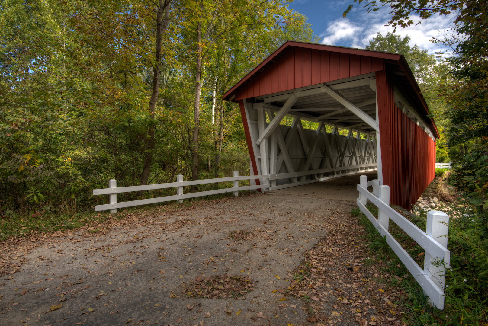
| My Favorite Spots | Blue Hen Falls The Ledges Kendall Lake Everett Covered Bridge Buttermilk Falls |
| Expenditures | Hotel: Not Recorded Flight: Not Recorded Rental Car: Not Recorded Food: Not Recorded |
| Miles Hiked | ~8 |
| # of Photos Taken | Not Recorded |
The Trip Overall
Cuyahoga Valley is a different kind of national park. It is woven into the urban sprawl between Cleveland and Akron, OH. In many places, you can convince yourself that you are away from it all, but in others the Interstate is a main feature of the landscape. I spent two days in the park as part of a week-long road trip around Ohio and West Virginia. I visited in late September after a particularly dry summer so was disappointed by the lack of flow in the waterfalls and my mis-timing of the Fall colors. It is certainly worth a look, but I wouldn’t rank it high on a list of must-see attractions.
The Map
Cuyahoga Valley is nestled right into the city. There are interstates and major highways throughout. For getting around in the park, the roads are quite nice. The park is tall and narrow. The majority of the attractions I saw, and the main attractions in the park, were closer to the southern end. Riverview Rd. is your main avenue for cruising the park from north to south.
[googlemaps https://www.google.com/maps/d/embed?mid=zIXJEv-oh99o.kYjR4OGSZ3p8&w=1200&h=600]
Click on the camera icons to see a photo, a location name, and coordinates for the closest parking area. I also show park entrances, visitor centers, the hotel(s) where I stayed, hiking trails, and airports.
Visitor Statistics
Being close to cities like Cleveland and Akron, Cuyahoga Valley gets a steady stream of visitors. There are bike lanes and hiking trails that I’m sure are popular with locals. I visited at the end of September when the leaves were just starting to change. I was about 2 to 3 weeks too early. Peak fall color tends to hit around mid-October.
This graph shows the average number of visitors each month. Hover over the line to see values for each month. NOTE: Even though the X-axis reads “2000,” these are monthly averages from the most recent 5-year period. The “2000” should be ignored.
The Climate
The weather was perfect for my trip. Temperatures were in the mid-70’s, the days were mostly overcast and I caught a couple of great sunsets. Sunrises were a bust, but the overcast really helped for the waterfall pictures during the day.
This graph shows average temperature and precipitation by month. Hover over the line to see values for each month. You can select different variables and parks in the panel on the left. NOTE: Even though the X-axis reads “2000,” these are monthly averages of NOAA weather data dating as far back as the early 1900’s. The “2000” should be ignored.
Logistics
| NPS Survey Findings(1) | |
|---|---|
| % Visiting for First Time | 15% |
| % Staying More than 24 Hours | 2% |
| Average Length of Stay | 4.4 Hours |
| Top 5 Attractions | Towpath Trail (69%) Canal VC (20%) Boston Store (20%) Virginia Kendall Park (18%) Brandywine Falls (16%) |
| Average Expenditures | $50 per visitor group |
| (1) Visitor Survey Project Report Cuyahoga Valley National Park 2005 | |
Lodging
I stayed at the Holiday Inn Express in Richfield, Ohio. It was 10-20 minute drive from the places where I wanted to spend sunrise. It had a great continental breakfast and was comfortable. The park isn’t very large, so pretty much anywhere you stay will be a short drive from your destination.
Food
Since I drove, I brought along some groceries, though I did eat at some of the fast food places near the hotel. It’s not exactly urban, but there are no shortage of restaurants and chain places around Richfield. Cleveland and Akron are a short drive away if you’re looking for something more special.
My Experience
Cuyahoga Valley was the first stop on a week-long road trip around Ohio and West Virginia. I planned two days in the park and that worked out quite well. I didn’t take a long hike, but I did see all of the sites that I was interested in. I took a couple of photos I was happy with and shot some video.
Day 1
I left Washington, DC around 5 a.m. and drove straight through to the park. It’s about a 5 1/2 hour drive. I arrived at the park’s northern edge around 11. I was ready by that time to get out and walk so I went looking for Great Falls at Tinker Creek. I parked in what I thought was the right parking lot and walked toward the sound of rushing water. It turned out not to be the falls, but I found a fast moving stream and walked around there for a while. Since the boundaries of the park are a bit fuzzy, I’m not sure if I wandered out of the park or into a city park, but the area was filthy. There were piles of beer cans and plastic bottles.
After I stretched my legs a bit, I headed to Bridal Veil Falls and found it completely dry. I realized then that waterfalls were going to be a challenge on this trip. I jumped in my car and headed to the Boston Store Visitor Center to get my souvenir of choice, an embroidered patch, and a park map. The visitor center was busy and I had to circle a couple times to find a spot. I then made the short drive to Blue Hen Falls.
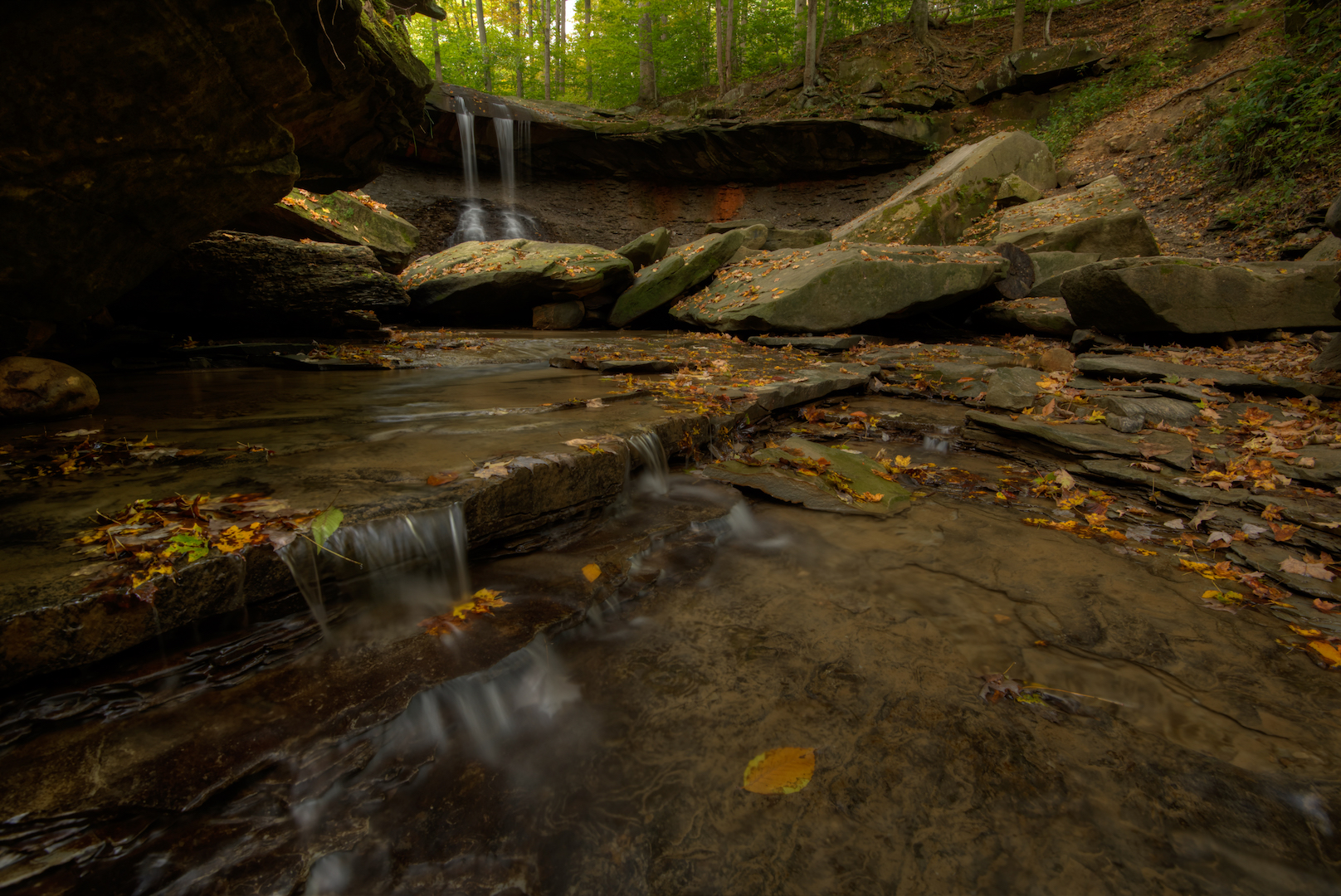
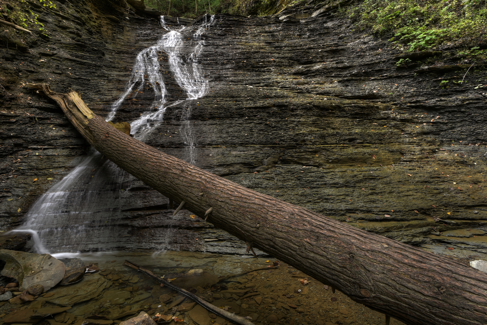
Of all the attractions in the park, I’d researched Blue Hen Falls (below left) the most thoroughly. I was excited to photograph it in ideal light, but since the other areas had been a bust, I made my first visit there in the middle of the day. I used that time to scout the location for a return trip and I took some video footage. While I was there, I talked to a couple who suggested I walk the additional mile or so to Buttermilk Falls (below right). Much like the other falls I’d seen that day, Buttermilk Falls was just a trickle.
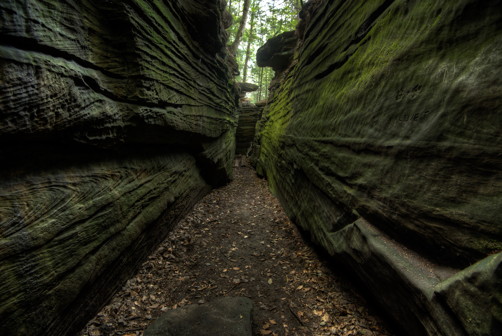
At that point, I went to check into my hotel and prepared to head back out that evening. My plan was to spend sunset on a westward facing cliff at The Ledges. I arrived at the parking area at The Ledges a couple hours before sunset and walked some of trails in the area. I walked about half a mile out and then slowly meandered my way back toward the cliff. The Ledges is a series of large, broken boulders. The cracks form hallway and room-like areas that are overgrown with trees and moss. It is a beautiful area and was my favorite place in the park. I found the area difficult to photograph, but had fun anyways.
After squeezing in and out of some rock formations, I moved on to where I intended to spend sunset. I got there an hour before sunset. When I first arrived there were two people there. Over that hour, I watched more and more people show up. In the end, there were maybe 30 people there. In researching the location, I had a few different ideas for shots I wanted to take. In the end, I couldn’t move much without blocking someone else’s view or having people in my shot so I stayed put and tried some different settings on my camera and slightly different compositions.
Day 2
On Day 2, I woke up well before sunrise and drove the 20 minutes to Brandywine Falls. This is one of the park’s main attractions. I arrived when it was still dark out and used my headlamp to navigate the few hundred yards of stairs and boardwalks to the falls’ overlook. Brandywine was flowing well, but still did not make for very exciting photography material. The most spectacular photos I’d seen of the falls came with vibrant Fall colors. That was not the case when I was there. I stayed at the overlook until a bit after sunrise, switching lenses, trying different settings and different compositions. I was there all by myself for over an hour. I walked around the falls to see if I could get a better angle and didn’t see anything else I liked. I ran into a couple and their photographer, there for an engagement photo shoot. They climbed over some fences and went to the brink of the falls (which was hardly flowing so it was safe), and would have been in any photos of the falls. I decided then that it was time to move on.
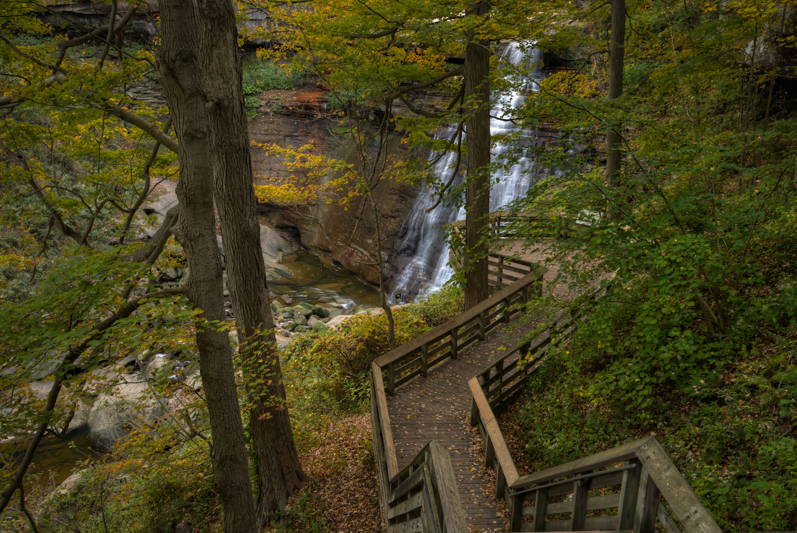
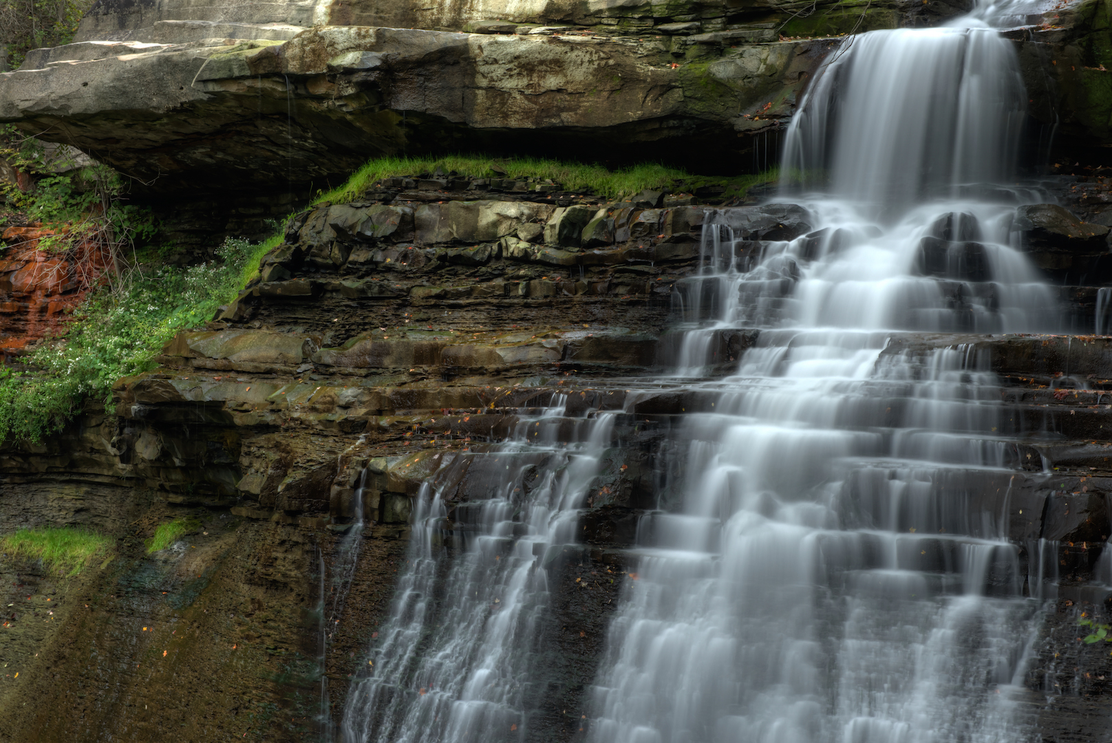
The best of the sunrise light that there might have been was long gone, but it was overcast and dim. I decided to head back to Blue Hen Falls. The falls is hemmed in by trees so the overcast didn’t present an issue and, in fact, helped with long exposure shots. I spent another two hours at Blue Hen Falls, shooting photos and video.
After a couple hours, I was done with trickling waterfalls and wanted to see some historic structures. I drove to the southern end of the park to the Hale Farm & Village. I didn’t realize that it was a paid attraction. I wasn’t interested enough to pay the fee so I wandered along a fence to get a photo of a barn. I was quickly stopped by someone who worked there and told that I couldn’t take photos without paying and that, even if I did pay, I couldn’t use a tripod. I found that funny because, even at close to 11 a.m., there were only a handful of people there. Not being one to argue, I moved along.
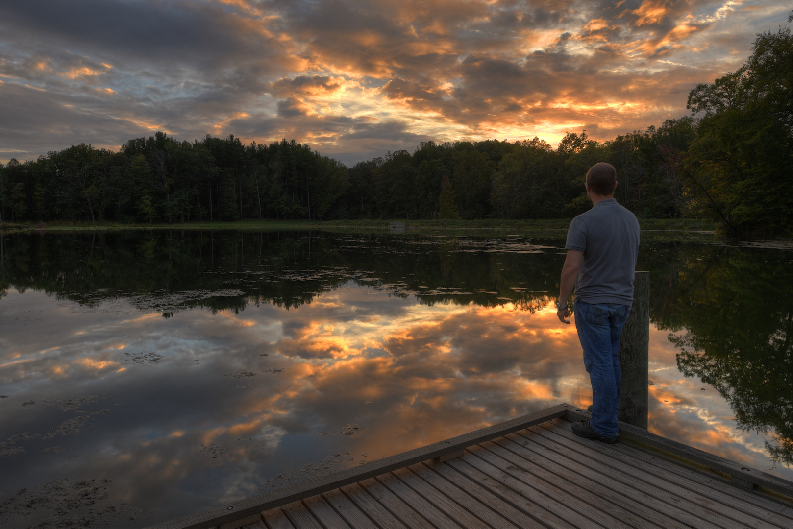
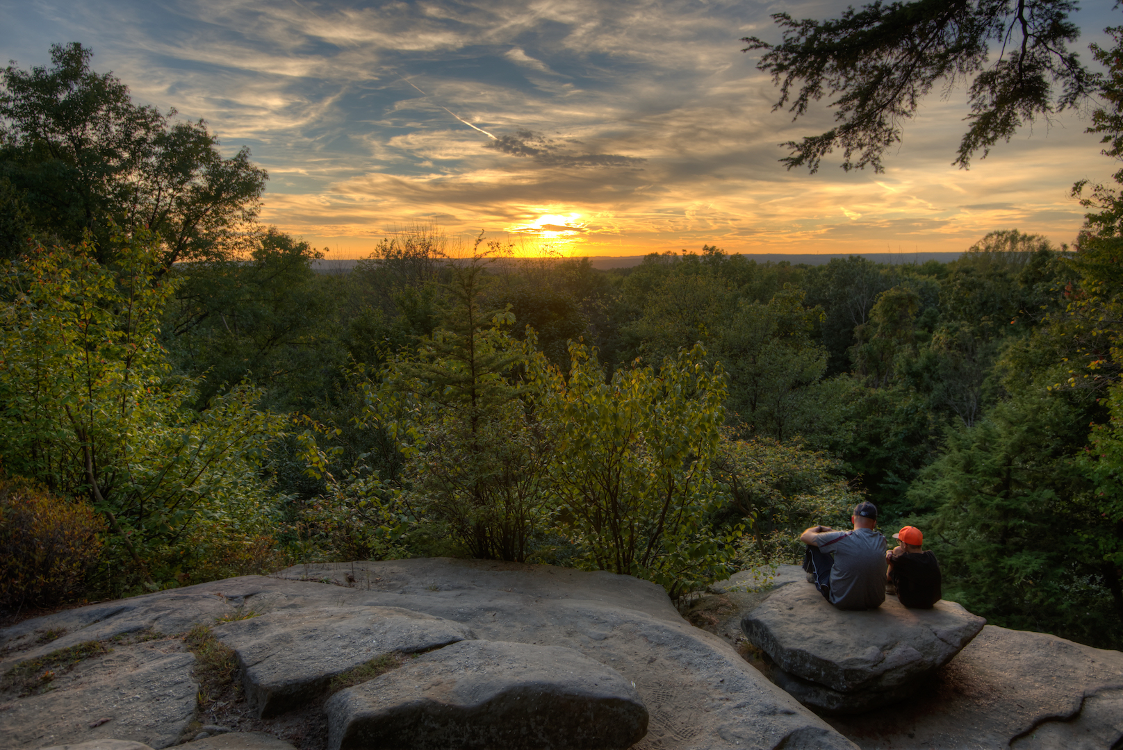
I got in my car and drove to the Everett Covered Bridge…about a mile away. It’s a beautiful bridge, but the clouds had broken and the light was starting to get harsh. I did my best, but gave up and went back to my hotel for a nap. I don’t remember what I did during that time, but I didn’t go back out until close to sunset that evening. About two hours before sunset I arrived at Kendall Lake. I walked the half-mile loop around the lake looking for good vantage points for sunset photos and then settled for a spot close to the parking area. I set up my camera close to the edge of the lake and sat on a bench, enjoying the view. About half an hour before sunset, it became obvious that it was going to be a good one. It didn’t disappoint. I ended up getting about 20 minutes of beautifully lit sky to work with. I alternated between pictures of the reflections, of the bench, of me on the bench. Ultimately, the foreground didn’t do justice to the sky in the background. It was still an amazing sight.
Day 3
On my last morning in the park, I drove to the Beaver Marsh before sunset. I wanted to photograph a series of boardwalks that run through the marsh. It was raining when I left my hotel so I wasn’t hopeful. When I arrived it was still dark and I, once again, put on my headlamp. I wandered down the dirt path about a quarter mile to where the boardwalk started. By that time the rain had let up, but the overcast never did. I waited through the sunrise time before giving up and heading back to the hotel for breakfast. Later that morning, I made the 3 hour drive to Hocking Hills State Park in southeastern Ohio…which was a much better photography location.
What I Would Do Differently
As I mentioned at the outset of this post, two things diminished this trip for me; the lack of flow in the waterfalls and fall color in the leaves. Both of these issues could have been fixed with better research and timing on my part. I knew going in that the leaves wouldn’t be great. They were close to great in West Virginia, where I ended my trip. I was surprised by the waterfall situation though. I don’t have any near-term plans to go back to Cuyahoga Valley, but if I do, it will be in the late Spring once leaves have had a chance to grow, but water is still flowing or later in October when I can get some fall color.
The One Shot
I mentioned earlier that Blue Hen Falls was the area of the park I researched the most. I thought a lot about that photo, but didn’t have a good sense from other people’s photos what the area looked like. That’s why I spent a good chunk of my time shooting video while I was there. I wanted to put together a video that gives a photographer a sense of what it’s like to photograph there.
[youtube https://youtu.be/oNtWwJfif48]
Other Resources
- Cuyahoga Valley National Park on NPS.gov – Get information straight from the people who know best.
- My Cuyahoga Valley National Park Gallery on Flickr – A collection of my photos from this trip on Flickr.
- My Cuyahoga Valley National Park Pinterest Board – My collection of other people’s photography from this park.
- My Other National Park Galleries on Flickr – A collection of all my National Park Galleries. I’m planning on building this collection as I visit new parks, so check back.
Useful Tools
- The Photographer’s Ephemeris – TPE allows you to drop a pin on a Google map and see not only the sunrise/sunset and moonrise/moonset times but also the direction the sun and moon will rise and set.
If you have any questions or comments about this article, let me know using my Contact page.