| My Experience | |
|---|---|
| Number of Visits | 1 |
| Length of Stay | 1.5 Days |
| My Favorite Spots | High Dune Zapata Falls Medano Creek Unnamed Road Pullouts — |
| Expenditures | Hotel: Not Recorded Flight: Not Recorded Rental Car: Not Recorded Food: Not Recorded |
| Miles Hiked | ~6 |
| # of Photos Taken | Not Recorded |
The Trip Overall
I visited the sand dunes as my first stop on a 5-day trip around southern Colorado. I did not make the most of the two days I spent in Great Sand Dunes National Park. It was cold in the mornings which kept me in my warm sleeping bag. I was also not physically or mentally prepared for walking in the sand despite watching videos of people warning how difficult it would be. Hiking to the top of High Dune, was the hardest workout I’d had in years.
Yet I still managed to get a few decent photos out of it. In fact, I got one of my favorite photos out of that trip (see The One Shot below). I definitely want to get back to the park, but that will be some time down the road.
The Map
There really isn’t much to plot on a map. There aren’t any defined trails (on the dunefield side at least). There are only two named points in the dunefield. The rest is just explore at your leisure. I didn’t venture into the mountains, but I’m sure there are some great points there as well.
[googlemaps https://www.google.com/maps/ms?msa=0&msid=215447723233123953430.0004ff2ed5038d91cdf83&hl=en&ie=UTF8&t=h&ll=37.739092,-105.527458&spn=0.033938,0.083599&z=14&output=embed&w=1200&h=600]
Click on the camera icons to see a photo, a location name, and coordinates for the closest parking area. I also show park entrances, visitor centers, the hotel(s) where I stayed, hiking trails, and airports.
Visitor Statistics
I don’t think it ever gets really busy at Great Sand Dunes. It is not like Yellowstone or the Grand Canyon. When I was out for sunrises and sunsets, I only saw one or two people out. I was there on a Monday, prior to Memorial Day, when several busloads of school kids showed up, but that wasn’t until around 9 o’clock. From the little bit that I saw, I would guess that 95% of visitors stay between the Visitor’s Center and High Dune. That’s as far as I ventured. There are vast areas beyond that if you want some alone time.
This graph shows the average number of visitors each month. Hover over the line to see values for each month. NOTE: Even though the X-axis reads “2000,” these are monthly averages from the most recent 5-year period. The “2000” should be ignored.
The Climate
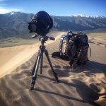 The one element of weather that tripped me up isn’t represented in the graph below and it’s not something you can avoid through planning…the wind. The dunes wouldn’t exist if it wasn’t for wind blowing sand around, so I wasn’t surprised. I was immediately conscious of the possible effect the sand might have if it got into my camera. I decided before I even went that I wouldn’t change my lenses while out in the dune field. I also made sure to bring my camera’s rain cover. If you don’t have one I recommend you get one and a UV filter to protect the lens on your camera. I had both of them on while I was hiking, but mostly kept my camera in my bag. I leaned more heavily on my phone and GoPro.
This graph shows average temperature and precipitation by month. Hover over the line to see values for each month. You can select different variables and parks in the panel on the left. NOTE: Even though the X-axis reads “2000,” these are monthly averages of NOAA weather data dating as far back as the early 1900’s. The “2000” should be ignored.
Logistics
| NPS Survey Findings(1) | |
|---|---|
| % Visiting for First Time | 63% |
| % Staying More than 24 Hours | 23% |
| Average Length of Stay | Not Reported |
| Top 5 Sites Visited | Dunes Parking Lot (91%) Visitor Center (84%) High Dune (67%) Dunes Picnic Area (28%) Medano Creek Bed (23%) |
| Average Expenditures | Not Reported |
| (1) Visitor Survey Project Report Great Sand Dunes National Park 2002 | |
Lodging
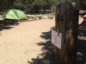
This was my first National Park camping trip. There are not many lodges, cabins, or hotels nearby, so camping seemed like the best way to stay in the thick of things. The Pinon Flats campground was nice. It is very basic. My site didn’t have electrical hookups and the campground doesn’t have shower facilities. The bathrooms are decent and for $20 a night, the experience was alright. I camped for two nights. It was fairly busy when I went at the end of May (but before Memorial Day), but there were still spots open. I recommend booking well ahead of time at Recreation.gov.
Food
There aren’t many food options around the park either. The closest towns are a 30 minute drive away. So I brought groceries with me. There is a camp store just outside the park. It has prepared sandwiches, cold drinks, and other things. I forget if it has an attached restaurant. I don’t think so. It is also the closest place to get fuel.
My Experience
As I mentioned in the intro, I didn’t enjoy myself at Great Sand Dunes as much as I hoped I would. When I was planning my trip around Southern Colorado, this was the place I was most looking forward to because I had never taken photos in a desert-like environment before. I thought about all of the abstract shots I would do of the waves in the sand, the high contrast shots when the sun is low in the sky, all of that. But when I hit the ground there was a 20 mile per hour wind and a lot of sand, and I immediately mellowed out.
Day 1
 I flew into the airport in Denver, got my rental car, and bought groceries. I picked up camping gear from a friend and hit the road by 1:00 pm. It was a boring 3.5 hour drive to the Dunes. When I got there, I set up my campsite and repacked all the gear I needed into my camera bag. After starting the day at 4:00 am in DC, I was finally ready to take some photos around 6:00 pm (8:00 DC time).
It was overcast, so I thought I wouldn’t get the photos I was looking for, but I was going to go explore anyways. I walked over to the dune field (which is about a half mile walk from the campgrounds) and that was the first time I realized that the wind was going to be a problem. I started to walk toward High Dune and quickly became discouraged when I realized how out-of-breath I was just walking up the first small dunes. Between the overcast, the wind, and my decrepitude I decided to walk along the base of the dune field instead.
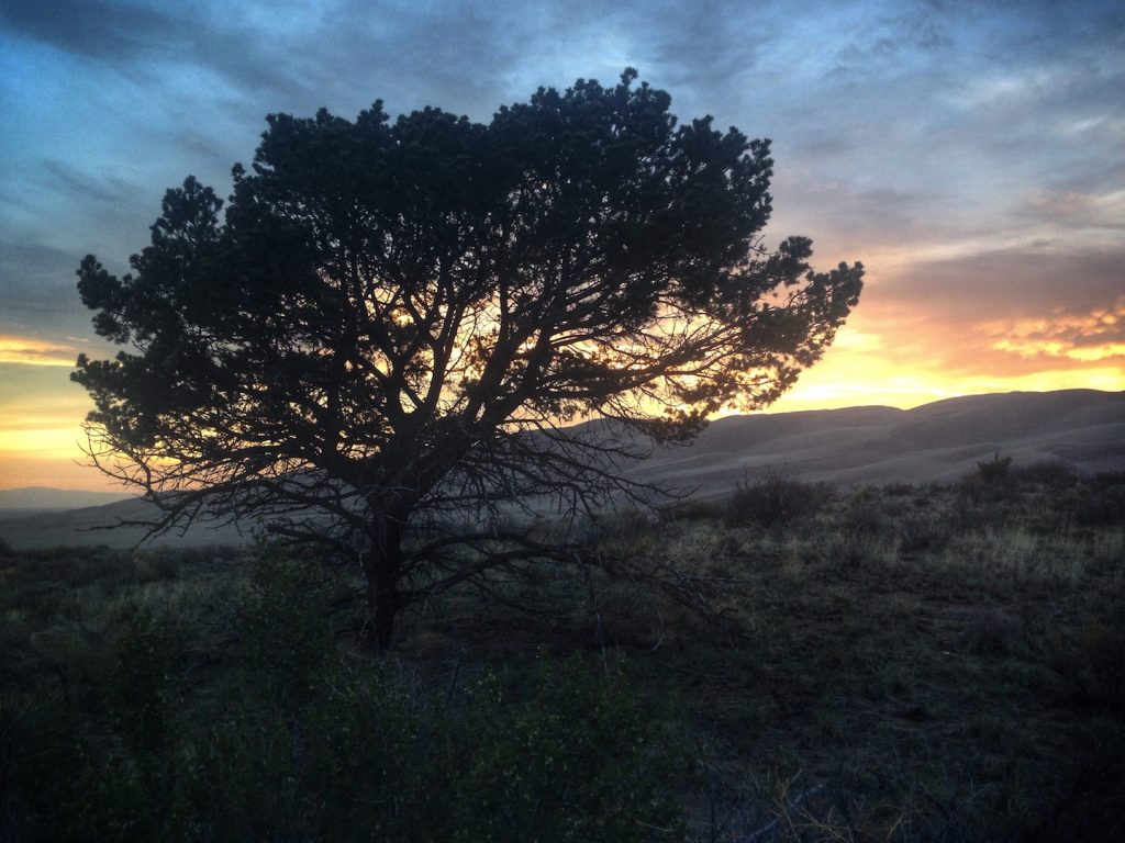
After about an hour of that I turned to head back to camp. It didn’t look like sunset was going to be worth sticking around for. I was halfway back when the colors started to pop and I was conflicted about what to do. I ended up taking a few cell phone photos, but was mad at myself as the colors became more intense. And then they were gone. I went back and fell asleep trying to get a cell signal strong enough to post my photos.
Day 2
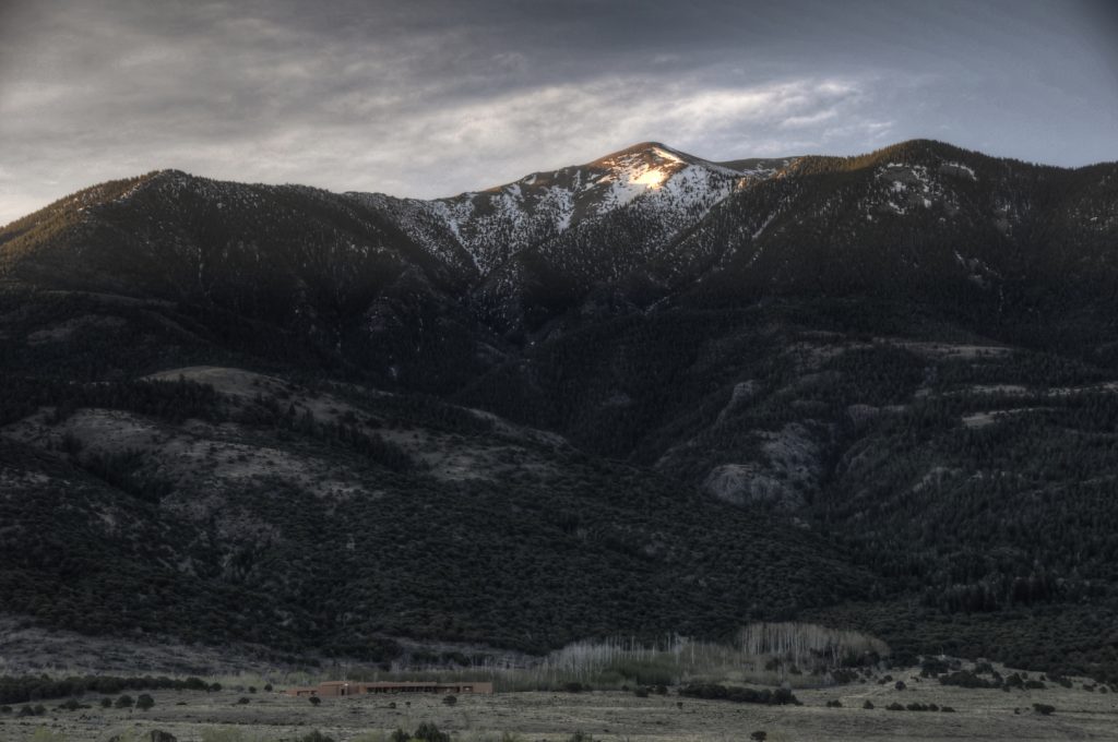 It was cold when I woke up in the morning and I was reluctant to get out of my sleeping bag. By the time I’d gotten dressed and ate breakfast it was almost sunrise. I drove down to the parking lot closest to the dune field, cutting out about 20 minutes of walking.
I was planning on walking down the south side of the dune field and getting abstract, light and shadow shots. For some reason, I decided I was going to start climbing the dunes and so I started up. If I had it to do over again, I would have taken a different route. The route I chose ended up getting too steep and I had to walk laterally across an equally steep downhill slope. I would slide a step or two to the right for every step I took forward. I had to stop about every 30 steps to catch my breath but there were a series of small goals that kept me going. I saw the top of a hill and thought that must be the top, only to find that there was some place behind it that was higher. It was all very claustrophobic until I got near the top of High Dune. That is where the vista really opens up and you can see the whole dune field.
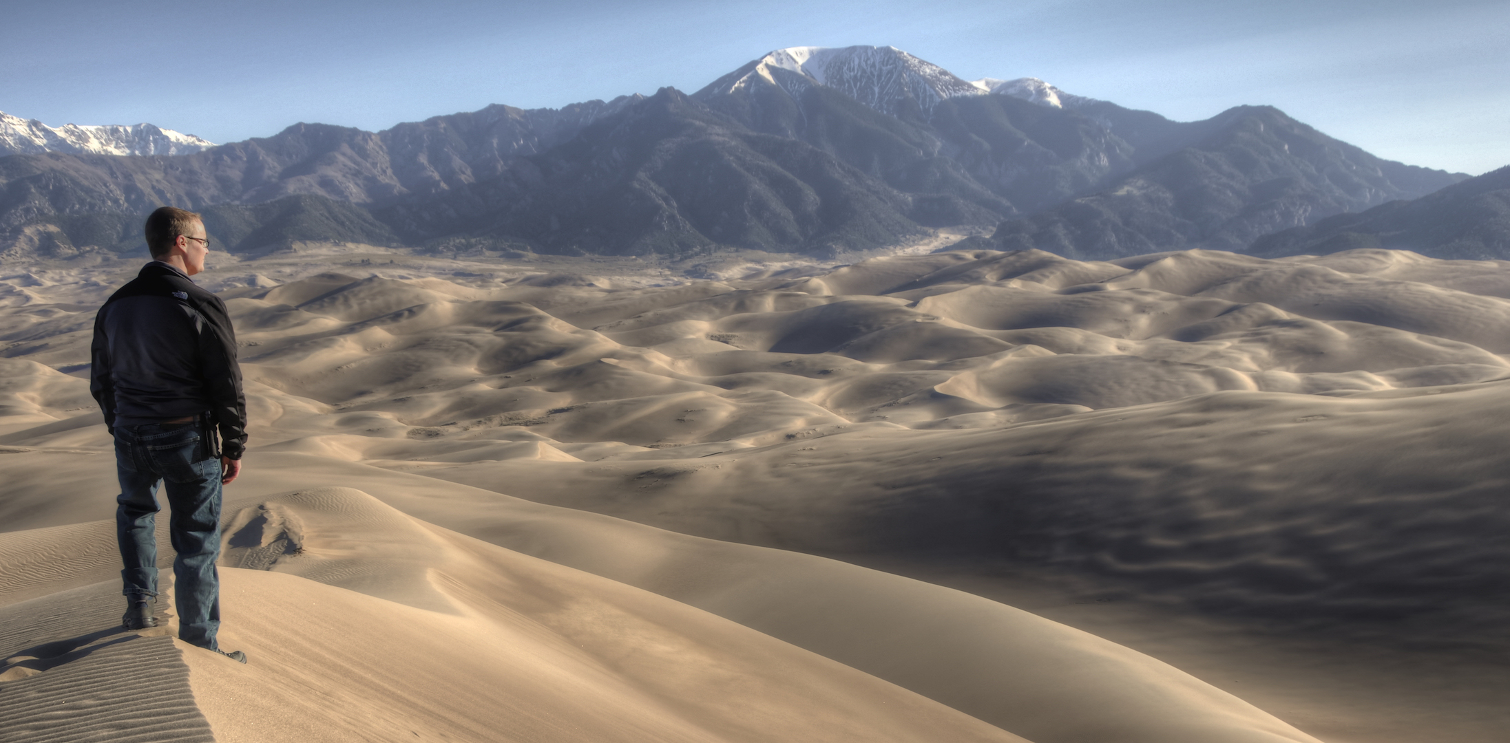
At the top of High Dune, there is nothing to block the wind so I felt the full force of it. It was probably still around 20 mph at that point. I finally took my camera out and put the rain cover on. After all of that walking, I was going to get some pictures. I spent about 45 minutes at the top of High Dune, taking landscape shots, selfies, and video.
I put my SLR away and kept the GoPro on the tripod on my way back down. I wanted to capture video that I hope to someday cut into a retrospective of that hike. It wasn’t until I was halfway down that I saw the first person in the dune field. It was around 8:30 by that point. When I got back to Medano Creek there were dozens of people out sledding and trudging through the creek. Several school busses full of kids were scurrying about the parking lot as I tried to get the sand out of my boots.

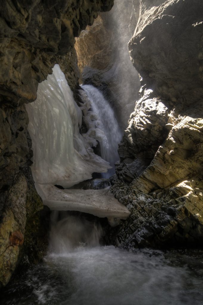
Once I’d “reset” myself, I decided to go to Zapata Falls. It’s just outside the park on State land, but I consider it an important part of that trip. The road to get up to the Zapata Falls trail was longer than I expected. It’s also winding and covered in large rock chunks rather than gravel so you have to drive very slowly. At the top of the hill you’re treated to a view of the sand dunes. To get to the falls, you have to walk an easy half mile trail. There’s some climb to it, but nothing a novice hiker couldn’t handle. To get the last 200 feet to the falls, you have to walk through a slot canyon with no shoreline. That means walking through the shallow stream. It’s only a couple inches deep and I managed to do it in boots without getting my feet wet. As you can see from the photo there was still a fair amount of ice, so the water was cold. I heard squeals from other hikers. The falls itself was tough to take photos of. You need a wide-angle lens if you want to get it all.
There wasn’t a cloud in the sky that afternoon and I knew I wasn’t getting any decent photos, so I spent the afternoon at my campsite, charging my phone and other electronic devices. The sunset was equally uninspiring, so I took that as an opportunity to get to sleep early.
Day 3
Before I left on the trip, I had planned to spend this morning walking through the dune field. As I sat in my car on Day 2, I decided that it would be better spent driving to the next stop on my itinerary, Mesa Verde National Park. I packed up my tent and hit the road around sunrise to make the 4 hour drive.
What I Would Do Differently
A lot, quite frankly. First, I would prepare my body before going. I’ve already started running to get my cardiovascular system back in order. Some things, like the elevation difference, are tough to prepare for. I would also like to spend some time hiking in the mountains that line the eastern edge of the dunes. Finally, I would hope, pray, sell my soul to the devil, whatever it took to get less wind.
The One Shot
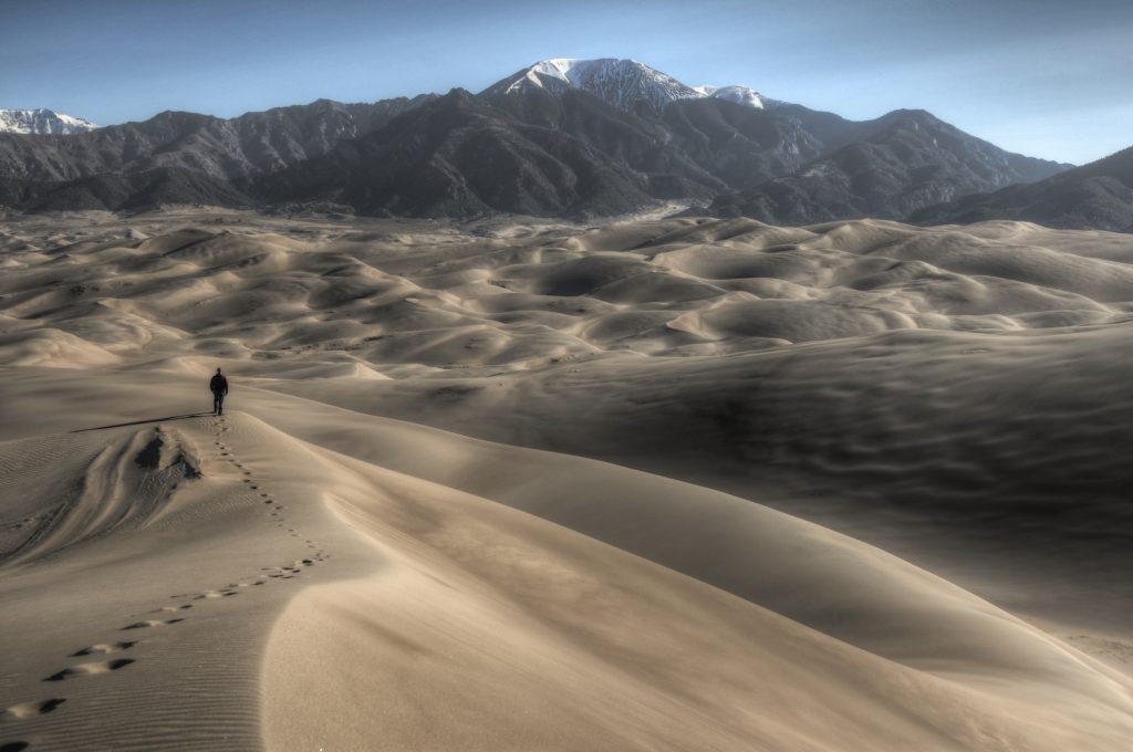
I never got the one shot that I most wanted to get before taking the trip. I wanted sunrise or sunset shots from the south end of the dune field. The low sun would cast dark shadows on one side of a dune, while lighting up the other. My various issues with weather and personal motivation kept me from getting out at the times I wanted. A close second, was a shot that showed the grand scale of the park. I did get that and it turned out to be my favorite shot from the whole trip to Colorado. In fact, it’s one of my all-time favorites. If only there’d been clouds to liven it up.
Other Resources
- Great Sand Dunes National Park on NPS.gov – Get information straight from the people who know best.
- My Great Sand Dunes National Park Gallery on Flickr – A collection of my photos from this trip on Flickr.
- My South Colorado National Parks Pinterest Board – My collection of other people’s photography from this park.
- My Other National Park Galleries on Flickr – A collection of all my National Park Galleries. I’m planning on building this collection as I visit new parks, so check back.
Useful Tools
- The Photographer’s Ephemeris – TPE allows you to drop a pin on a Google map and see not only the sunrise/sunset and moonrise/moonset times but also the direction the sun and moon will rise and set.
If you have any questions or comments about this article, let me know using my Contact page.
Pingback: Mesa Verde Dunes National Park – brandonkopp.com